Lidar Dgps

Advanced LiDAR and DGPS surveying for highly accurate terrain mapping, elevation data, and precise geospatial measurements.

Ensuring Accurate Mapping with LiDAR & DGPS

Advanced LiDAR and DGPS surveying plays a crucial role in capturing highly accurate terrain and geospatial data for infrastructure planning and engineering projects. Our services focus on delivering precise elevation models, detailed land mapping, and reliable positioning data to support informed decision-making.

Using modern LiDAR scanning technology combined with DGPS accuracy, we collect high-resolution spatial data that helps engineers, planners, and developers analyze terrain conditions and design projects efficiently.

High-precision LiDAR scanning & DGPS positioning
Accurate terrain mapping and elevation data
Detailed geospatial data for engineering projects
Reliable data for planning, design, and construction

Why Choose Our LiDAR & DGPS Survey Services

Accurate LiDAR and DGPS surveying is essential for precise terrain mapping and reliable geospatial data collection. Our services provide high-resolution spatial information to support infrastructure planning, engineering design, and project development.

High-Precision Data Collection

We use advanced LiDAR scanners and DGPS technology to capture highly accurate terrain, elevation, and land feature data.

Detailed Mapping & Terrain Analysis

Our surveys generate precise topographic maps, digital elevation models, and geospatial data for engineering and planning.

Accurate Positioning & Measurement

DGPS technology ensures centimeter-level positioning accuracy for reliable and consistent survey results.


Reliable Data for Infrastructure Projects

Our survey reports support engineers, architects, and developers with accurate information for planning, design, and construction.

Advanced LiDAR & DGPS Survey Solutions
We provide comprehensive LiDAR and DGPS surveying services including high-precision terrain scanning, elevation data collection, and detailed geospatial mapping ensuring accurate information for infrastructure planning, engineering design, and project development.
Accurate & Technology-Driven Survey Process
Our survey process uses advanced LiDAR sensors and DGPS positioning systems to capture precise ground data, terrain features, and spatial measurements for reliable mapping and analysis.
Reliable Mapping & Data Support
From field data collection to final survey reports, we deliver accurate digital maps, terrain models, and geospatial datasets to support engineers, planners, and developers in making informed project decisions.
Our approach

Our Approach to LiDAR & DGPS Survey

We provide high-precision LiDAR and DGPS survey services to deliver accurate terrain mapping and geospatial data for infrastructure planning and engineering projects. Our approach focuses on capturing reliable elevation data, land features, and positioning information to support efficient project development.

Through advanced LiDAR scanning technology and DGPS positioning systems, we ensure accurate field data collection and detailed spatial analysis for better project planning and design.

Survey Planning & Site Preparation
We begin by understanding project requirements, survey objectives, and site conditions to develop an efficient survey strategy.
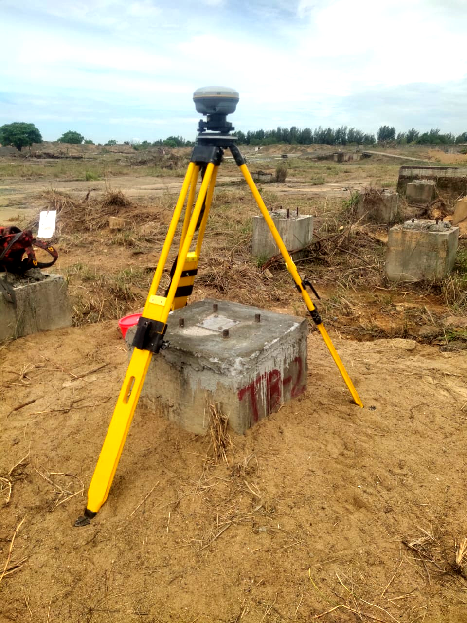
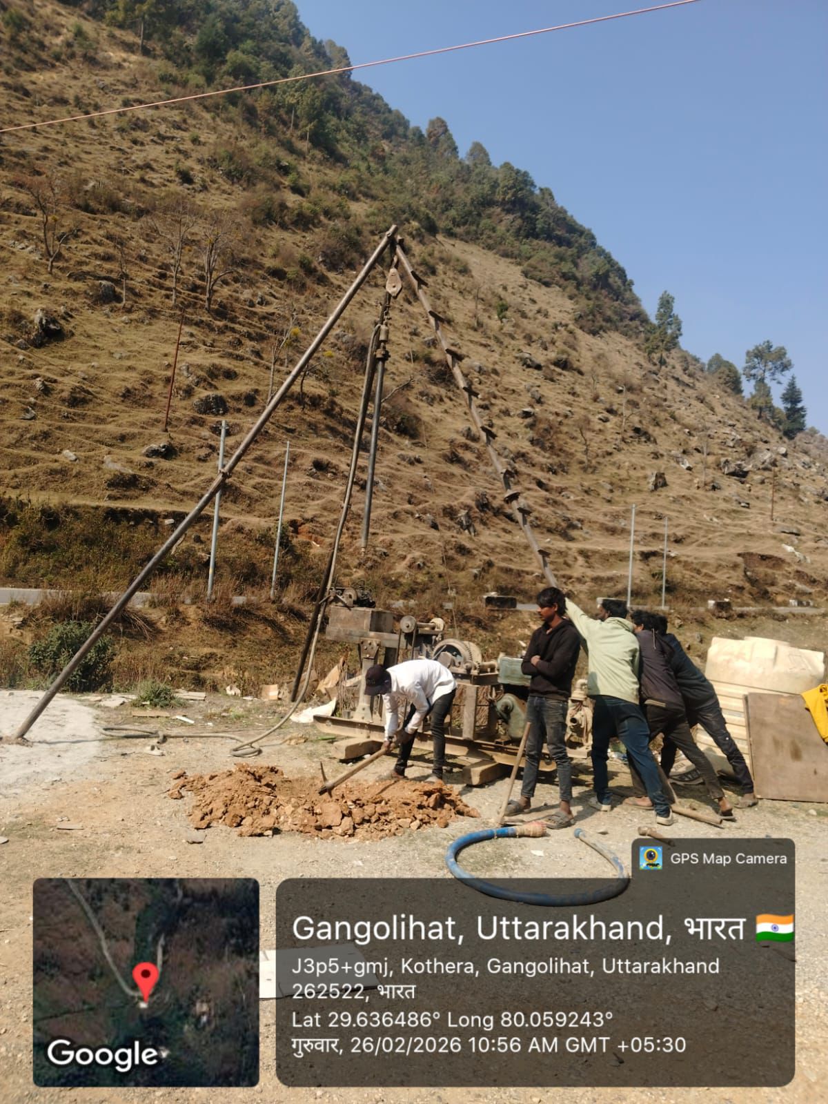
LiDAR Scanning & DGPS Data Collection
Our team uses advanced LiDAR sensors and DGPS equipment to capture precise terrain details, elevation data, and geographic coordinates.
Data Processing & Geospatial Mapping
Collected survey data is processed to generate accurate topographic maps, digital elevation models, and geospatial datasets for engineering and planning purposes.
how it work?

Our LiDAR & DGPS Survey Process

We follow a structured, step-by-step approach to ensure high-precision terrain mapping, accurate positioning, and reliable geospatial data for infrastructure planning and engineering projects.

Let’s Collaborate with Us!

2, Brar Complex near MS ENCLAVE,
Dhakoli, Zirakpur, Punjab – 140603
Call Consulting: +91 7696903181
Call Cooperate: +91 7696903182

    Frequently Asked Questions

    Some frequently asked questions about the service that you may have questions about

    Who are your typical clients?
    We work with a variety of clients. We work with the heads of municipalities’ transportation planning, traffic engineering or economic development departments, and with mayors’ offices.
    What is the process for beginning a project?
    We work with a variety of clients. We work with the heads of municipalities’ transportation planning, traffic engineering or economic development departments, and with mayors’ offices.
    Can you help a client get funding?
    We work with a variety of clients. We work with the heads of municipalities’ transportation planning, traffic engineering or economic development departments, and with mayors’ offices.
    What if my project lies outside your team’s skillset?
    We work with a variety of clients. We work with the heads of municipalities’ transportation planning, traffic engineering or economic development departments, and with mayors’ offices.
    Will you tell me how to run my business?
    We work with a variety of clients. We work with the heads of municipalities’ transportation planning, traffic engineering or economic development departments, and with mayors’ offices.
    Are you a data controller or processor?
    We work with a variety of clients. We work with the heads of municipalities’ transportation planning, traffic engineering or economic development departments, and with mayors’ offices.
    x

    Contact With Us!

    Head Office: 2, Brar Complex, Near M.S Enclave, Dhakoli, Zirakpur, Punjab – 140603

    Branch Office: H. No. 11, Lane No. 11, Indraprastha, Nathanpur, Nehrugram, Dehradun, Uttarakhand –
    248005

    Call us: +91-7696903181 / +91 76969 03182

    Mon – Sat: 8.00am – 18.00pm / Holiday : Closed

    Select the fields to be shown. Others will be hidden. Drag and drop to rearrange the order.
    • Image
    • SKU
    • Rating
    • Price
    • Stock
    • Availability
    • Add to cart
    • Description
    • Content
    • Weight
    • Dimensions
    • Additional information
    Click outside to hide the comparison bar
    Compare